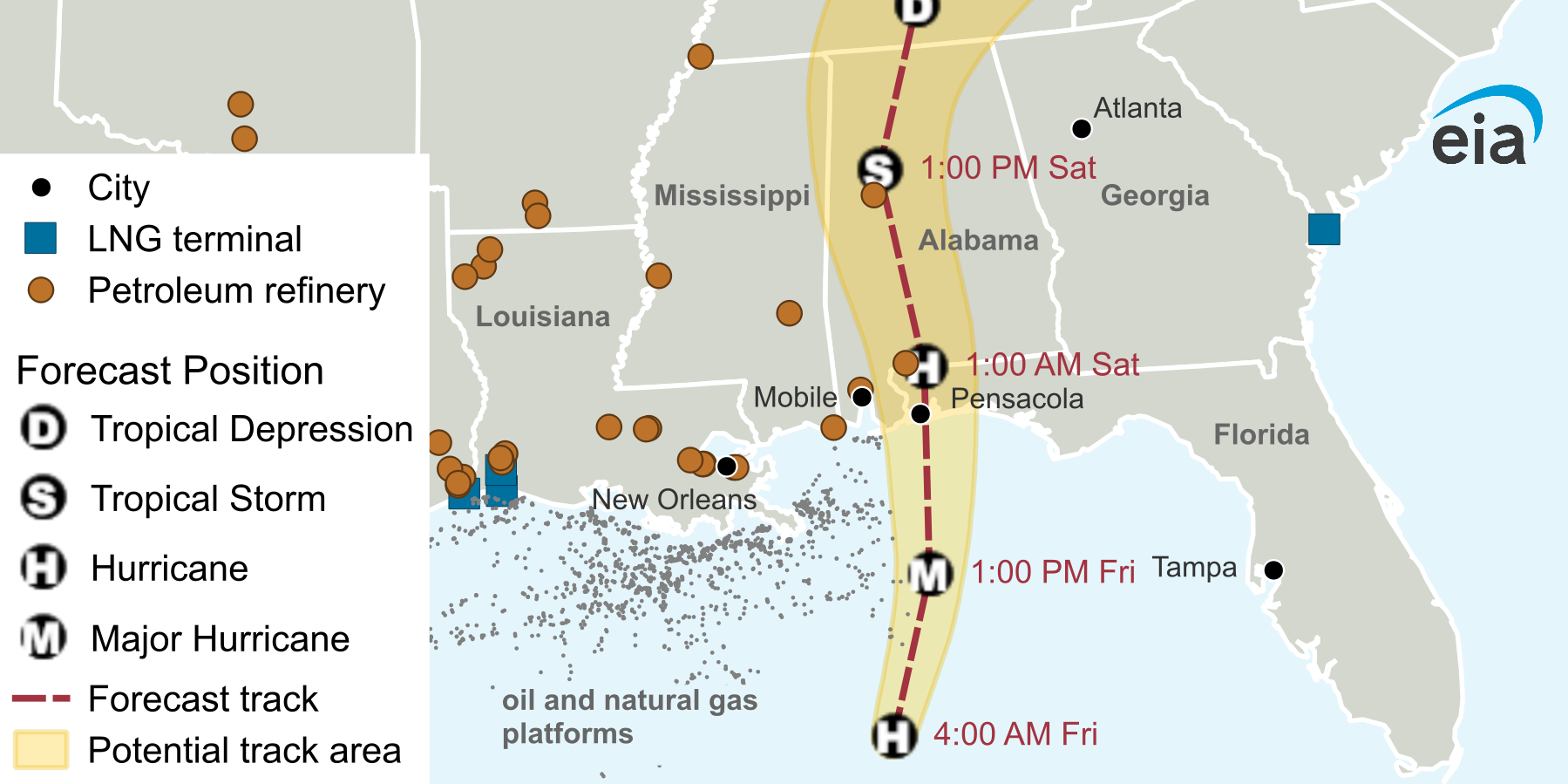
The U.S. Energy Information Administration published a map on Oct. 9 showing Hurricane Isaias on a forecast track toward the Gulf Coast, with petroleum refineries, LNG terminals and offshore oil and natural gas platforms plotted along the storm's path. Isaias is the first hurricane of the 2026 Atlantic season and is expected to be the largest storm system to make landfall in the region since Hurricane Helene in September 2024.
As of 4:00 a.m. central time on Oct. 9, the National Oceanic and Atmospheric Administration expected landfall late Friday or early Saturday. The Marine Minerals Administration reported that as of Thursday, Oct. 8, 130 production platforms and rigs had been evacuated or moved. Those evacuations produced production shut-ins of about 1.3 million barrels per day of crude oil.
The map marks forecast positions along the track. The storm is shown as a hurricane at 4:00 a.m. Friday, a major hurricane at 1:00 p.m. Friday, a hurricane near Pensacola, Florida, at 1:00 a.m. Saturday, and a tropical storm over Alabama at 1:00 p.m. Saturday. Refineries cluster along the Louisiana, Mississippi and Alabama coastline within and near the potential track area.
EIA noted that the U.S. Gulf Coast is home to a large portion of the U.S. refining fleet, and that impacts from Isaias could affect refinery operations.
Source: U.S. Energy Information Administration - https://www.eia.gov/todayinenergy/detail.php?id=68284